The Municipality has a number of maps to help the public learn about the different features of the communities.

Wards

All Wards 2022 2026

Detailed Ward Maps


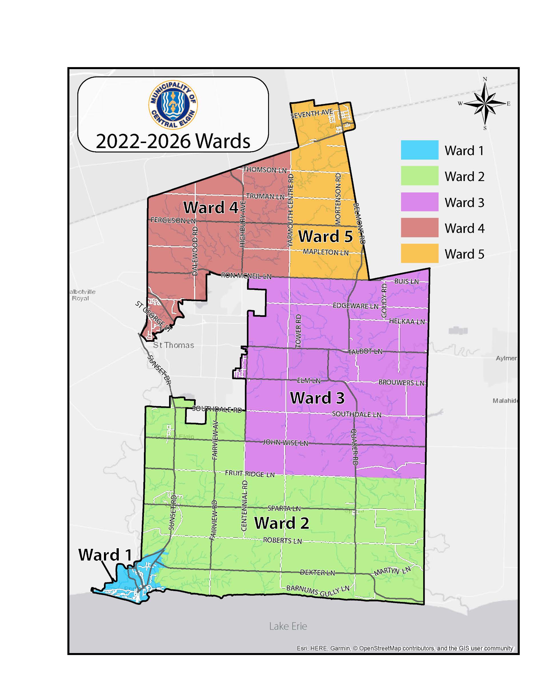
To see what ward you're in, search your address in the map below.

Interactive Map

The Municipality also offers an interactive map in which the public can search throughout Central Elgin for general property information.

Search the Interactive Map Here

Official Plan Maps

Municipal Wide Maps

Schedule 1 - Land Use Structure

Schedule A - Land Use

Schedule A1 - Roads Classification

Schedule A2 -  Environmental Features

Schedule A3 - Aggregate and Petroleum Resources

Community Based Maps

Belmont

Schedule B - Land Use

Schedule B1 - Roads Classification

Schedule B2 - Community Improvement

Lynhurst

Schedule C - Land Use

Schedule C1 - Roads Classification

Eastwood

Schedule D - Land Use

Schedule D1 - Roads Classification

Norman Lyndale

Schedule E - Land Use

Schedule E1 - Roads Classification

Union

Schedule F - Land Use

Schedule F1 - Roads Classification

Schedule F2 - Community Improvement

Port Stanley

Port Stanley Harbour Secondary Plan

Waterfront Master Plans

Schedule G - Land Use

Schedule G1 - Roads Classification

Schedule G2 - Natural Hazards

Schedule G3 - Port Stanley Harbour

Schedule G3 - 1 - Land Use

Schedule G3 - 2a Natural Hazards Overlay

Schedule G3 - 2b Natural Hazards Overlay

Schedule G3 - 3 Maximum Building Height

Schedule G3 - 4 Transportation Improvements

Schedule G4 - Community Improvement

New Sarum

Schedule H - Land Use

Schedule H1 - Road Classification

Orwell

Schedule I  - Land Use

Schedule I1 - Roads Classification

Sparta

Schedule J - Land Use

Schedule J1 - Roads Classification

Schedule J2 - Community Improvement